Streams Tech
hero bg

End-to-End Software Solutions for Business Challenges

We deliver high-quality software solutions that streamline operations and empower your organization

Hero showcase 1

170+

Projects Delivered

60+

Clients Worldwide

5

Continents Served

20+

Years of International Delivery

Working with Leading Organizations

Who We Build For

Different teams, for different reasons - each with a direct path through our services.

GIS Firms & Environmental Consultancies

GIS Firms & Environmental Consultancies

Agencies building spatial platforms who need reliable senior engineering capacity. We work as your offshore delivery team - white-label, full NDA, onboarded in 2 weeks. Esri/ArcGIS or open-source GIS - PostGIS, GeoServer, Leaflet - we work in your stack.

Explore GIS Solutions
International NGOs & Development Organizations

International NGOs & Development Organizations

Organizations running field programs across Africa and Asia who need GIS-enabled M&E systems, offline-first mobile tools, and MEAL platforms. We understand the domain - multi-country rollouts, low-connectivity environments, and donor reporting.

Explore MEL solutions
Government & Commercial Clients

Government & Commercial Clients

Municipalities, utilities, and commercial firms needing bespoke spatial applications, BI dashboards, or environmental modelling platforms. Delivered to US city governments, World Bank, and South African national agencies.

See our case studies
Software Teams & Enterprises

Software Teams & Enterprises

Technology companies and enterprises who need senior engineers embedded in their team. We've sustained 30+ engineer engagements over multi-year periods. Full IP ownership, US contract entity, competitive rates.

Explore team augmentation

Our Services

Built on deep domain expertise, delivered end to end.

Geographic Information System

Custom GIS applications, PostGIS & GeoServer backends, Leaflet and Mapbox frontends, offline-first field tools, satellite imagery analysis, and ArcGIS / QGIS integration. From national-scale government platforms to satellite monitoring systems.

View Details

Monitoring, Evaluation & Learning

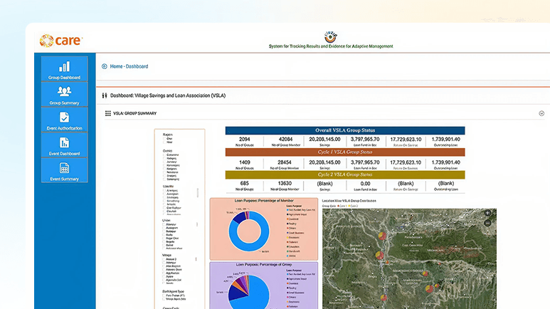
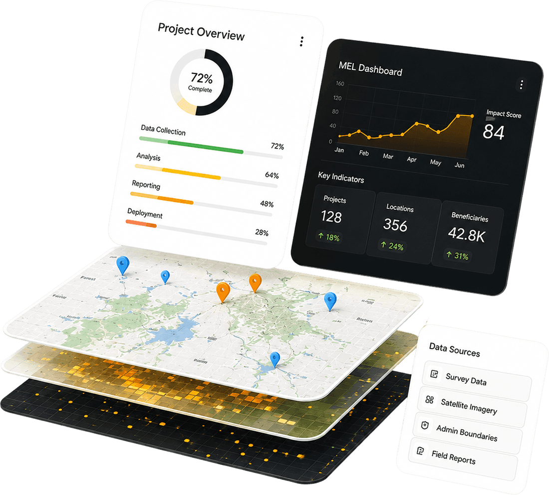
End-to-end MEL platforms - offline-first mobile data collection, beneficiary tracking, indicator dashboards, and donor-aligned reporting. Deployed for BRAC International across 7 African countries, serving 1M+ beneficiaries.

View Details

Team Augmentation

Senior engineers embedded in your team on demand - GIS specialists, .NET, Angular, Python, and React developers, QA, DevOps, and PMs. Fast onboarding, full NDA, and the kind of reliability that earns multi-year engagements with global clients.

View Details

Business Intelligence

Power BI, Apache Superset, and custom dashboards. Data pipelines and KPI reporting for government, NGO, and commercial clients.

View Details

Enterprise App Dev

Full-stack .NET Core, Python, and Node.js backends with Angular and React frontends. Built for complexity and multi-user enterprise environments.

View Details

Cloud Solutions

AWS-hosted GIS and MEL platforms, cloud-native architecture, legacy modernisation, and scalable DevOps pipelines for data-heavy workloads.

View Details

AI & Machine Learning

Applied ML for spatial analysis, satellite change detection, MEL data intelligence, and predictive analytics - grounded in real deployments, not generic claims.

View Details

Environmental Intelligence

SWMM-based stormwater modelling, flood risk, water quality, and climate resilience platforms. Proprietary GeoSWMM product for municipalities and engineering firms.

View Details

Choose Your Engagement Model

Whether you need engineers in your team, a full platform built, or a white-label delivery partner - we have a model that fits.

Augment Your Team
01
MOST POPULAR RIGHT NOW

Augment Your Team

Senior engineers embedded directly in your team - in your tools, repositories, and communication channels. GIS specialists, .NET, Python, Angular, React. We work the way your team works.

Full NDAUS contract entity
Onboarded within 2 weeks

White-Label Delivery Partner
02
FOR AGENCIES & CONSULTANCIES

White-Label Delivery Partner

You win the contract, we deliver it under your brand. No direct client contact, complete delivery accountability. Ideal for GIS firms and consultancies that need reliable offshore capacity without overhead.

Full IP transferFlexible team size
Longest relationships: 5+ years

Build From Scratch
03
FOR DIRECT CLIENTS

Build From Scratch

End-to-end delivery of GIS platforms, MEL systems, enterprise applications, and environmental intelligence tools. We own the delivery from architecture through deployment and handover.

Fixed scope or agileFull project team
Architecture → deployment → support

Modernise & Extend
04
FOR EXISTING PLATFORMS

Modernise & Extend

Upgrade legacy systems, migrate data pipelines, extend existing platforms. We integrate into your current architecture and improve it without starting over or disrupting live operations.

Codebase audit includedPhased delivery
No disruption to operations

Discover Our Success Stories

How we turn complex requirements into production-ready software that performs

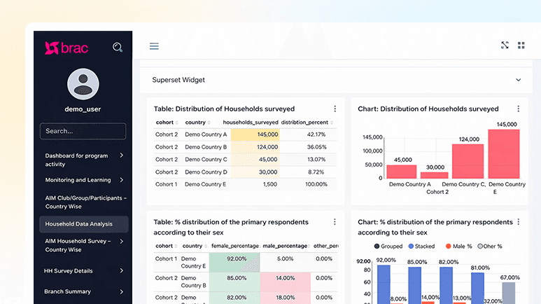
BRAC International - BInsight Platform

MELGIS7 CountriesInternational Development

BRAC International - BInsight Platform

Built and deployed BInsight - a GIS-enabled M&E platform for BRAC International's AIM programme, funded by the Mastercard Foundation. Serves 1M+ adolescent girls across Uganda, Tanzania, Liberia, Sierra Leone, Rwanda, Ghana, and Kenya. Offline-first mobile data collection, PostGIS backend, role-based dashboards for field teams, managers, and donors.

PostGISAngularOffline-firstAWSBRAC · Mastercard Foundation
LGED GIS Portal for Project Planning

MELGIS7 CountriesInternational Development

LGED GIS Portal for Project Planning

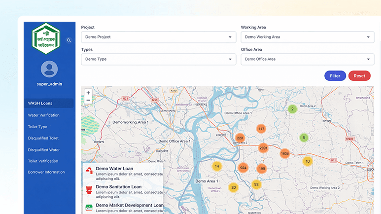
The Local Government Engineering Department (LGED) is Bangladesh's largest government engineering agency, overseeing rural roads, bridges, markets, and socioeconomic infrastructure across the entire country. Despite maintaining one of the most extensive GIS databases in the region - with a road network dataset exceeding 10 GB - LGED lacked an interactive, web-based platform for its engineers and planners to work with that data dynamically.

TestTest Two
World Bank - GeoDASH Spatial Platform

GISGovernmentDisaster Risk Management

World Bank - GeoDASH Spatial Platform

Designed and built GeoDASH - a web-based GIS platform funded by the World Bank, enabling Bangladesh government agencies to collaborate on spatial data, create custom maps, and support national-scale disaster risk management. Real-time spatial updates, cloud storage, GIS import/export, and multi-agency access for government users.

World Bank fundedNational scaleGovernmentCloud GIS
GeoTerraImage - South Africa Water Monitoring

EnvironmentalMLRemote SensingAfrica

GeoTerraImage - South Africa Water Monitoring

Built a cloud-based satellite data platform delivering monthly nationwide surface water maps across South Africa using ML-powered Sentinel-2 imagery classification. Big data spatial analysis at national scale, supporting water resource management decisions for a leading South African geospatial firm. A real ML deployment grounded in environmental science.

Sentinel-2 MLNational scaleCloud platformPython
BRAC International - BInsight Platform

MELGIS7 CountriesInternational Development

BRAC International - BInsight Platform

Built and deployed BInsight - a GIS-enabled M&E platform for BRAC International's AIM programme, funded by the Mastercard Foundation. Serves 1M+ adolescent girls across Uganda, Tanzania, Liberia, Sierra Leone, Rwanda, Ghana, and Kenya. Offline-first mobile data collection, PostGIS backend, role-based dashboards for field teams, managers, and donors.

PostGISAngularOffline-firstAWSBRAC · Mastercard Foundation
LGED GIS Portal for Project Planning

MELGIS7 CountriesInternational Development

LGED GIS Portal for Project Planning

The Local Government Engineering Department (LGED) is Bangladesh's largest government engineering agency, overseeing rural roads, bridges, markets, and socioeconomic infrastructure across the entire country. Despite maintaining one of the most extensive GIS databases in the region - with a road network dataset exceeding 10 GB - LGED lacked an interactive, web-based platform for its engineers and planners to work with that data dynamically.

TestTest Two
World Bank - GeoDASH Spatial Platform

GISGovernmentDisaster Risk Management

World Bank - GeoDASH Spatial Platform

Designed and built GeoDASH - a web-based GIS platform funded by the World Bank, enabling Bangladesh government agencies to collaborate on spatial data, create custom maps, and support national-scale disaster risk management. Real-time spatial updates, cloud storage, GIS import/export, and multi-agency access for government users.

World Bank fundedNational scaleGovernmentCloud GIS
GeoTerraImage - South Africa Water Monitoring

EnvironmentalMLRemote SensingAfrica

GeoTerraImage - South Africa Water Monitoring

Built a cloud-based satellite data platform delivering monthly nationwide surface water maps across South Africa using ML-powered Sentinel-2 imagery classification. Big data spatial analysis at national scale, supporting water resource management decisions for a leading South African geospatial firm. A real ML deployment grounded in environmental science.

Sentinel-2 MLNational scaleCloud platformPython
Technology Stack Background

Technology Stack We've Got You Covered

No matter the platform or framework, we have the expertise to deliver

iOSiOS
React NativeReact Native
AndroidAndroid
IonicIonic
Vue JSVue JS
React JSReact JS
AngularAngular
FlutterFlutter
Next JSNext JS
iOSiOS
React NativeReact Native
AndroidAndroid
IonicIonic
Vue JSVue JS
React JSReact JS
AngularAngular
FlutterFlutter
Next JSNext JS

Tailored Solutions for All Industries

Domain-informed engineering: precise to your industry, measurable in outcomes

Government

Government

Enabling governments with secure digital solutions and GIS-driven systems for smarter governance.

Multilateral Organizations

Multilateral Organizations

Utilities

Utilities

Agriculture

Agriculture

Academia and Research

Academia and Research

Healthcare

Healthcare

Transportation

Transportation

Land Development Agencies

Land Development Agencies

Private  Organization

Private Organization

Non-profits

Non-profits

Government

Government

Multilateral Organizations

Multilateral Organizations

Utilities

Utilities

Agriculture

Agriculture

Academia and Research

Academia and Research

Healthcare

Healthcare

Transportation

Transportation

Land Development Agencies

Land Development Agencies

Private  Organization

Private Organization

Non-profits

Non-profits

Why Teams Choose Streams Tech

01

Specialist Depth in Three Domains

GIS platforms, MEL systems, and enterprise software - not a generic shop that claims to do everything.

02

Stack-Agnostic Delivery

.NET or Python backends, Angular or React frontends - we work in your environment, not ours. No technology religion.

03

US-Registered, Globally Accountable

A US legal entity with a senior engineering team in Dhaka. Enforceable contracts, full IP transfer, competitive rates.

04

Long-Term Partnerships

Our longest engagements run 3–5 years. We embed, learn your codebase, and stay - not a project vendor.

05

Field-Tested Engineering

Offline-first apps, low-bandwidth optimisation, GPS tools. Built for where your clients actually operate.

Looking for an Engineering Partnerss You Can Rely On?

Whether you're building from scratch, modernizing, or extending your team